Firefighters on the Bend-Fort Rock and Crescent Ranger Districts plan to resume prescribed burning operations on Tuesday if conditions remain favorable.
Bend-Fort Rock Ranger District firefighters plan to continue prescribed burning approximately 10 miles south of Bend and five miles east of Sunriver along Forest Service Road 9721 for 413 acres on Tuesday. A small portion of the prescribed burn will be adjacent to Forest Service Road 9703 which provides access from Lava Lands Visitor Center to Highway 97. No road or trail closures are anticipated; however, drivers should slow down and use caution around firefighters and fire vehicles. Smoke will be highly visible from Bend and Sunriver. Sunriver and south Bend may experience some smoke impacts. Oregon Department of Transportation and flagging personnel will monitor conditions on Highway 97. This prescribed burn is within the Rocket Vegetation Management Planning area and has been previously thinned, pile burned and mowed. The fuels reduction work in this area decreases the potential for catastrophic wildfire to impact Sunriver. Firefighters may continue with ignitions in this area through the week if conditions remain favorable.
Firefighters on the Crescent Ranger District plan to continue prescribed burning up to 79 acres located six miles southwest of Crescent, two miles west of Highway 97 and four tenths of a mile from Highway 58. The prescribed burn unit is located two miles southeast of Cascade Estates Subdivision and two miles northeast of the Two Rivers Subdivision. Smoke may cross Highway 97 during burn operations; however, smoke is expected to rise over the roadway. Signs will be posted on both Highway 58 and Highway 97.
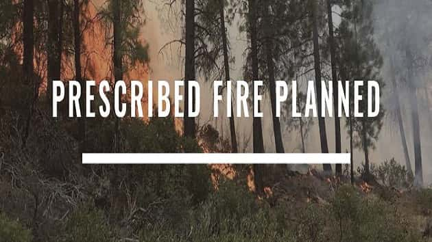
Prescribed burning reintroduces and maintains fire within a fire-dependent ecosystem helping to stabilize and improve the resiliency of forest conditions while increasing public and firefighter safety. Once firefighters ignite prescribed burns, they monitor and patrol the units until they declare the burn out.
These prescribed burns are occurring within the Central Oregon Landscape, one of 21 focal landscapes identified within the Forest Service’s Wildfire Crisis Strategy. The implementation of these prescribed burns supports the Deschutes National Forest’s commitment to addressing the Wildfire Crisis Strategy which aims to reduce severity of wildfires, protect communities and improve the health and resiliency of fire-dependent forests.
Prescribed burns can protect homes from tragic wildfires. Fire management officials work with Oregon Department of Forestry smoke specialists to plan prescribed burns. Prescribed burns are conducted when weather is most likely to move smoke up and away from our communities. Sometimes, weather patterns change, and some smoke will be present during prescribed burns.
What does this mean for you?
During prescribed burns, smoke may settle in low-lying areas overnight.
- All residents are encouraged to close windows at night to avoid smoke impacts
- When driving in smoky areas, drivers should slow down and turn on headlights
- If you have heart or lung disease, asthma, or other chronic conditions, ask your doctor about how to protect yourself from smoke
- Go to centraloregonfire.org to learn more about smoke safety and prescribed burning in Central Oregon
For more information on prescribed burning in Central Oregon, visit centraloregonfire.org/ and for information specific to the Deschutes National Forest visit www.fs.usda.gov/deschutes. Follow us on Twitter @CentralORFire. Text “COFIRE to 888-777 to receive wildfire and prescribed fire text alerts.