
As Oregonians prepare for one of the busiest travel periods of the year, the Oregon Department of Emergency Management (OEM) is urging residents and visitors to take extra precautions. A series of weather systems will bring rain, mountain snow, and increasingly strong winds through Wednesday, creating potentially hazardous travel conditions across the state and may bring additional power outages.
According to the National Weather Service, waves of snow showers, gusty coastal winds, and a potential for strong inland winds may impact travel—particularly over mountain passes, on the coast and along the I‑5 corridor.
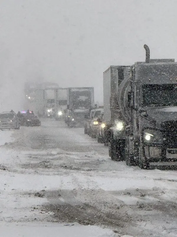
Weather Hazards to Expect
Mountain Snow and Pass Travel
- Snow showers will continue through Tuesday, with snow levels between 2,500 and 4,000 feet.
- Travelers crossing the Cascades should expect slick roads, reduced visibility.
- Strong Winds
- Breezy to gusty winds return to the coast and Coast Range today, with a 45–70% chance of gusts exceeding 45 mph.
- A stronger wind event is possible Wednesday, with a 25–50% chance of major wind impacts, including:45–58 mph gusts inland
- 55–70 mph gusts along beaches and headlands
- The I‑5 corridor may experience up to six hours of peak gusts, though exact timing remains uncertain.
Coastal Thunderstorms
- A 10–25% chance of thunderstorms exists along the coast today, bringing the potential for locally heavy rain, small hail, gusty winds, and occasional lightning.
River Conditions
- Minor flooding will persist along the Pudding River at Aurora through today, though levels are trending downward.
- Latest river forecasts: https://water.noaa.gov/
Safety Concerns Beyond the Weather
Fallen Trees and Power Outages
Recent heavy rainfall has left soils saturated across western Oregon. Combined with strong winds, this increases the likelihood of downed trees and power lines. Travelers should be prepared for:
- Sudden road blockages
- Localized outages
- Delays on major routes
- Tree limbs can break without warning, especially in high winds or under the weight of snow and ice, so be extra cautious when walking outdoors.
- Read more about power outage safety here.
Hazardous Water Conditions
OEM strongly advises the public to stay out of rivers, streams, and coastal waters. As runoff from last week’s atmospheric river continues moving through the system:
- Waterways contain high levels of debris, including branches and logs
- There is potential for sewage contamination
- Fast‑moving, cold water increases the risk of injury or drowning
Travel Preparedness Guidance
Check Conditions Before You Go
- Expect delays and allow extra travel time. Rushed drivers are unsafe drivers.
- Fill up your gas tank. Be prepared for taking longer detours or remaining idle for an extended periods of time due to traffic jams by having plenty of gas in your tank.
- Visit TripCheck.com or call 511 for real‑time road conditions, chain requirements, and incident updates.
- Make sure you have Wireless Emergency Alerts activated on your phone and are Signed up for emergency alerts for the area in Oregon you are visiting by going to ORAlert.gov and typing in your destination’s zip code.
- If you are visiting another state, search for that state’s Department of Emergency Management and look for their instructions on how to receive alerts.
- If you end up stuck in snow, keep your car running as much as possible to stay warm, but keep the area around your exhaust pipe clear.
Give Snowplows Space
- Never pass a snowplow.
- Maintain a safe following distance—plows often create clouds of snow that reduce visibility.
- Crews need room to operate safely; your patience helps keep everyone on the road safer.
- For more safe winter driving tips visit the Oregon Department of Transportation’s Winter Driving Safety webpage, or read this article on Getting Ready for Winter Driving.
Pack an Emergency Car Kit
OEM recommends every vehicle carry:
- Warm clothing and blankets
- Water and non‑perishable food
- Flashlight and extra batteries
- Chains and traction devices
- Ice scraper and shovel
- First‑aid supplies
- Phone charger and backup power
- Sand or kitty litter for traction
- Back up phone charger and hand cracked weather radio.
If You Encounter Downed Trees or Power Lines
- Never touch or move downed lines
- Report hazards to local authorities
- Treat all lines as energized
Looking Ahead
Forecast confidence suggests a calmer, drier pattern returning by Saturday, December 27. However, OEM encourages the public to remain vigilant and stay informed as conditions evolve.